

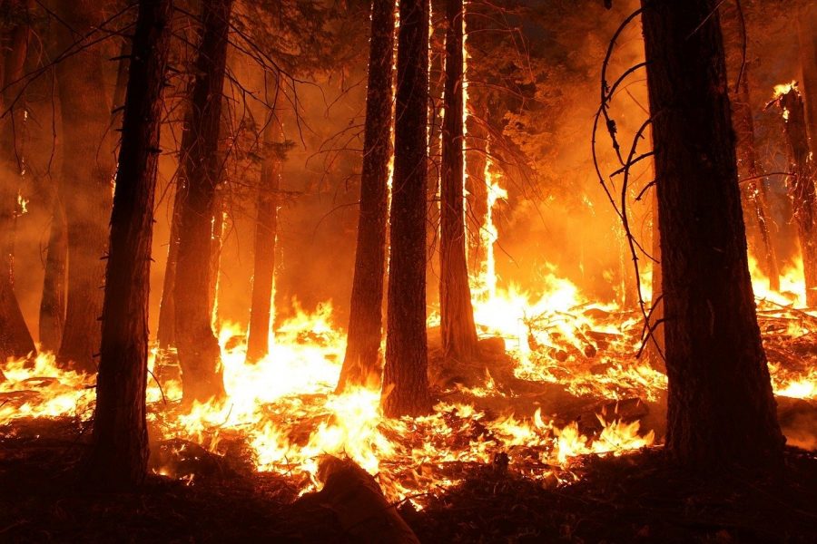
California Fire Updates
This is a recurring story. Follow @lahstalon on Instagram and Twitter for more updates.
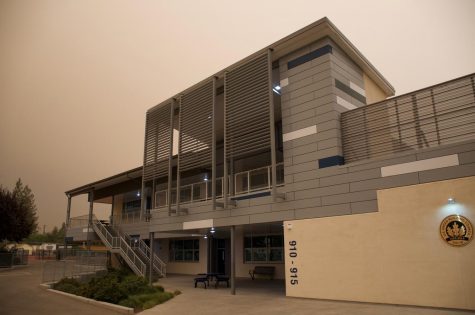
Wednesday, September 9, 7:16 p.m. — High atmosphere smoke blots out sun.
Numerous fires have rapidly flared up within the past week, forcing evacuations in parts of Northern California and Oregon. Smoke from these fires was blown toward the Bay Area and has settled at a high level, blotting out the sun and causing crimson skies. Note that the smoke remains at a high level in the atmosphere, and the air quality remains relatively unaffected at 89 — moderate (via IQAir.com).
Thursday, August 27, 7:58 p.m. — Crews make progress containing blazes.
As of Cal Fire’s last update, the SCU fires have been 35% contained, CZU 21% and LNU 33%. There are currently 7 confirmed fatalities and 1,890 destroyed structures.
Tuesday, August 25, 3:46 p.m. — Palo Alto warning lifted.
Cal Fire has lifted the evacuation warning for the parts of Palo Alto bordering Los Altos Hills. However, the situation is still developing and may change rapidly. As of 3 p.m., the Air Quality Index (AQI) in Los Altos stands at 166 — “unhealthy” (via iqair.com).
Monday, August 24, 11:00 a.m. — Red flag warning canceled.
The National Weather Service has canceled the red flag warning early for the Bay Area, meaning the forecast no longer expects dry lightning. As of 10:45 a.m., Cal Fire still has parts of Palo Alto under an evacuation warning on its website.
Monday, August 24, 9:26 a.m. — No lightning struck Bay Area or Central Coast last night.
Cal Fire officials report a progressive shift against the CZU complex fires last night, as the storm cell brought none of the anticipated lightning in the Bay Area or Central Coast region. However, the Bay Area still remains under a red flag warning until 5 p.m. today, and parts of Palo Alto bordering Los Altos Hills continue to be under an evacuation warning.
Sunday, August 23, 7:46 p.m — Parts of Palo Alto issued evacuation warnings.
Parts of Palo Alto bordering Los Altos Hills have been issued evacuation warnings by Cal Fire. Although these are warnings and not orders, consult authorities immediately if you believe you fall into the affected regions.
The new warnings come in light of a chance of dry lightning storms, which would further aggravate conditions. Residents in evacuation warning zones are encouraged to prepare to evacuate as further orders may be released in the coming hours.
Saturday, August 22, 4:44 p.m. — Air quality reaches “very unhealthy” levels.
Fires continue to rage in the SCU, CZU and LNU fire complexes, resulting in deteriorating air quality. As of 4 p.m., the Air Quality Index is at 204 in Los Altos and 219 in Mountain View — “very unhealthy” — and 198 in Los Altos Hills — “unhealthy” (via iqair.com).
Outdoor exertion should be avoided, particularly for those with lung disease or other sensitive groups.
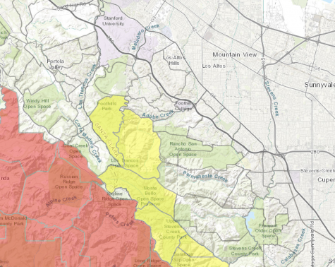
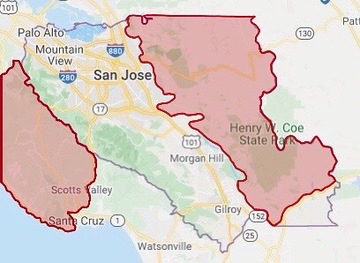
Friday, August 21, 11:20 p.m. — Correction: previous Talon maps were misleading.
Correction: Previous maps The Talon released of evacuation orders in Santa Clara County were misleading, but there are still no orders in Los Altos, Los Altos Hills or Mountain View. The eastern evacuation zone in SCC extends further south than The Talon originally interpreted from Cal Fire’s evacuation orders. See below for a new map, which also shows evacuation orders along Santa Clara County’s border in San Mateo and Santa Cruz counties. Please consult local authorities if you believe you may fall in one of these zones.
As of 11:20 p.m., the Air Quality Index (AQI) in Los Altos stands at 31 — “good” (via iqair.com).
Friday, August 21, 3:34 p.m. — NWS issues dry lightning warnings.
While major fires continue to burn in the SCU lightning complex, the National Weather Service has issued dry lightning warnings spanning Sunday, August 23, through Tuesday, August 25, which could lead to increased fires.
As of Cal Fire’s last update today, the fire containments are as follows: SCU at 10 percent, LNU at 7 percent and CZU at 0 percent.
There are currently no warnings or evacuation orders for Los Altos, Los Altos Hills or Mountain View.
As of 3 p.m., the Air Quality Index (AQI) in Los Altos stands at 165 — “unhealthy” (via iqair.com).
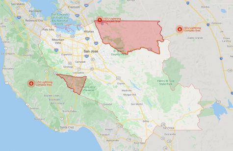
Friday, August 21, 9 a.m. — SCC expands evacuation orders.
As the SCU Lightning Complex fires continue to burn alongside the CZU and LNU fires, Santa Clara County has expanded its evacuation orders. See below for an updated map of the evacuation orders in Santa Clara County and a map of the SCU and CZU fires. Note that neither Los Altos, Los Altos Hills nor Mountain View are included in any of the orders.
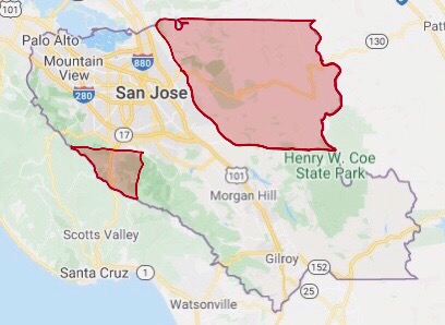
(Via forestobservatory.com)
As of 9 a.m., the Air Quality Index (AQI) in Los Altos stands at 99 — “moderate” (via iqair.com).
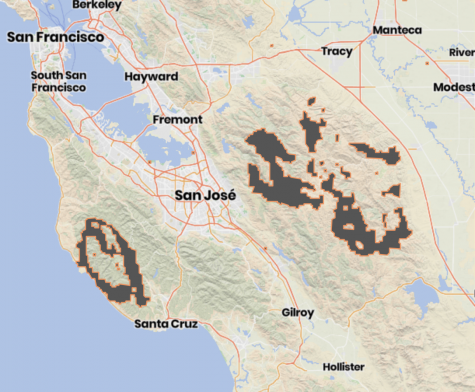
Wednesday, August 19, 11:40 a.m. — Multiple blazes burn in California counties.
Major blazes are burning in parts of Alameda, Contra Costa, Napa, Solano, San Mateo, Santa Clara, Santa Cruz and Sonoma counties. Below is a map of the evacuation orders in Santa Clara county. Please note that there are currently no evacuation orders in Los Altos, Los Altos Hills or Mountain View.
As of 11:40 a.m., the Air Quality Index (AQI) in Los Altos stands at 179 — “unhealthy” (via iqair.com).